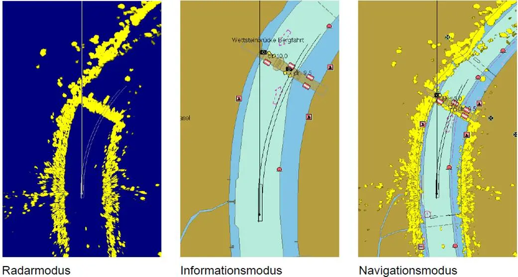
Precision Navigator II
Le seul système de navigation combinant radar, AIS intérieur et ECDIS
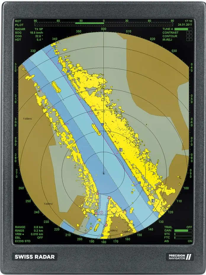
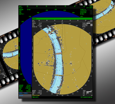
Technologie SyncPlot
Synchronisation parfaite du radar et de l'ECDIS
La technologie SyncPlot garantit une synchronisation parfaite entre les échos radar et les cartes ECDIS, assurant un alignement visuel instantané et une expérience de navigation fluide. Cela est crucial pour réduire le risque de mauvaises interprétations, en particulier dans des conditions de visibilité réduite.
- Alignement instantané des échos radar et des cartes ECDIS.
- Aucun retard ni décalage. Indispensable pour une navigation sûre par faible visibilité.
- Affichage d'images en temps réel fluide et stable.
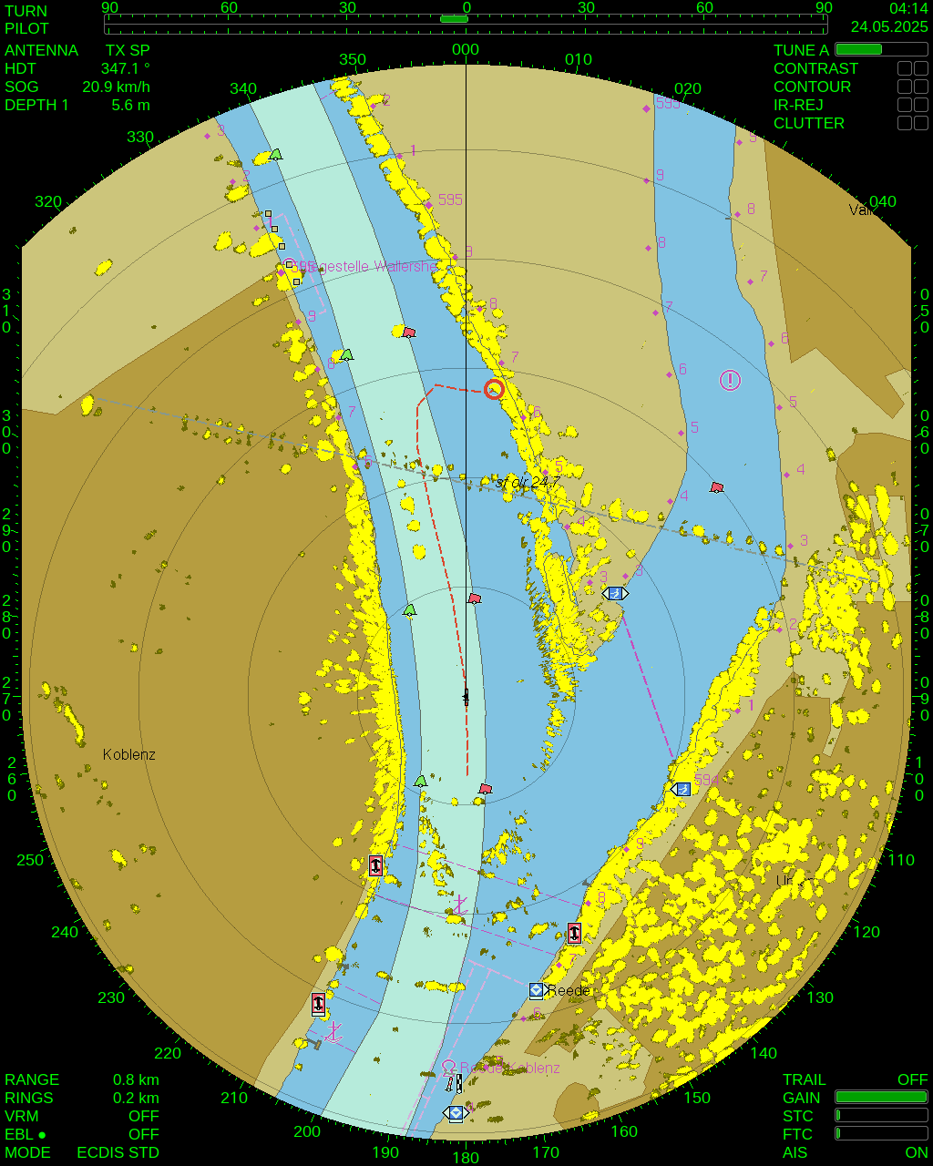
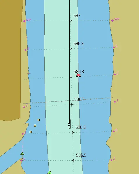
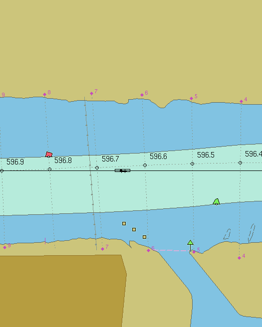
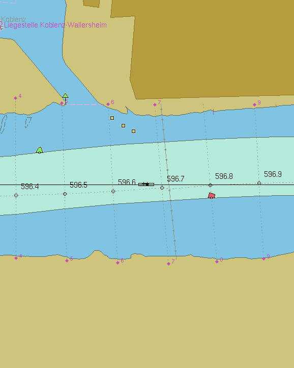
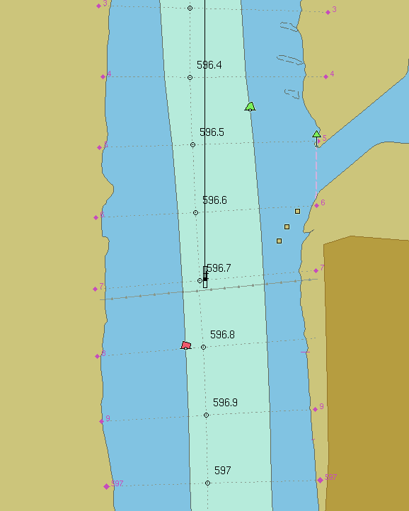
Prédiction de Position
Découvrez l'avenir de votre navigation
Notre fonctionnalité de Prédiction de Position vous aide à visualiser le parcours anticipé de votre navire en fonction de la vitesse actuelle et de la direction. Cette prévoyance permet des ajustements de cap en temps réel pour optimiser les manœuvres et éviter les obstacles potentiels.
- La ligne de prédiction montre la trajectoire future du navire.
- Visualisez le parcours en fonction de la vitesse et de la direction actuelles.
- Optimisez les manœuvres et évitez les obstacles en toute simplicité.
- Indispensable pour les voies navigables étroites ou à fort trafic.
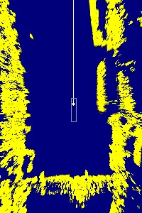
Clutter Filter
Image radar claire même dans des conditions difficiles
Notre Clutter Filter avancé réduit les interférences provenant de facteurs environnementaux tels que la pluie ou les vagues, garantissant une image radar claire et précise. Cela aide à améliorer la détection des cibles et la précision globale de la navigation dans des conditions météorologiques difficiles..
- Réduit les interférences causées par la pluie et les vagues.
- Des images radar plus nettes pour une détection fiable des cibles.
- Filtrage réglable pour différentes conditions météorologiques et de circulation.
- Précision de navigation améliorée avec suivi actif.
 Clutter + Contraste
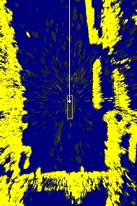
Clutter-Filter
Non filtré
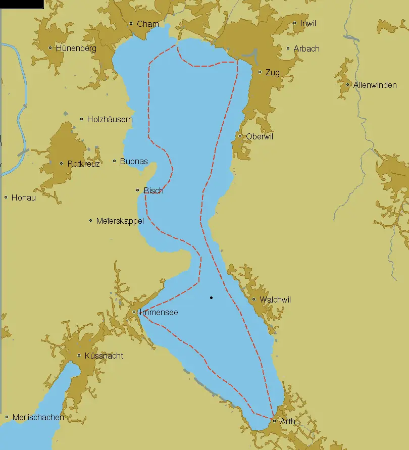
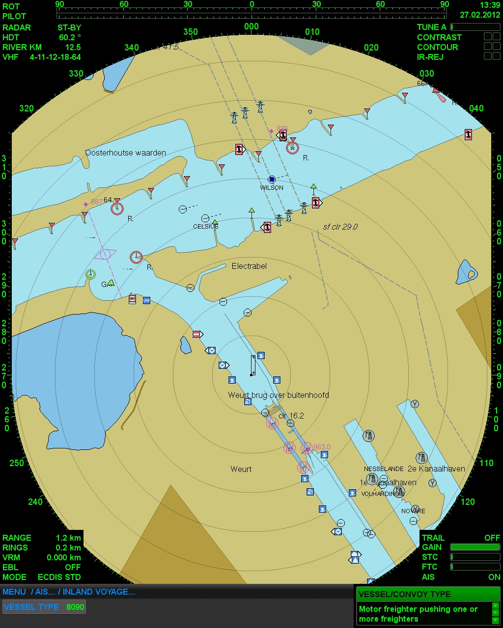
Option de Route
Planifiez et ajustez vos itinéraires en toute simplicité
La fonctionnalité Option de Route vous permet de planifier votre voyage à l'avance, avec la possibilité d'ajuster les itinéraires dynamiquement en fonction des conditions de circulation ou météorologiques. Cette flexibilité garantit un voyage sûr et efficace tout en optimisant la consommation de carburant.
- Planifiez et enregistrez des itinéraires directement dans le système.
- Navigation automatique par points de cheminement pour des trajets optimisés.
- Ajustements dynamiques pour répondre au trafic et à la météo.
- Économies de carburant grâce à un guidage routier efficace.
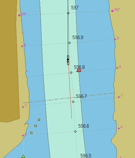
Option de Suivi
Suivre et analyser les mouvements des navires
Avec notre option de suivi, vous pouvez surveiller et examiner les mouvements passés des navires, identifier les écarts par rapport au parcours prévu et optimiser les itinéraires futurs. Cette fonctionnalité est inestimable pour améliorer l'efficacité opérationnelle et la sécurité.
- Suivi automatique des itinéraires passés.
- Analyser les manœuvres et optimiser les stratégies de navigation.
- Créer de nouveaux itinéraires basés sur des pistes enregistrées.
- Améliorez l'efficacité et la sécurité grâce à des informations sur les performances historiques.
Option de Ferry
Adapté aux opérations de ferry
L'option Ferry offre la flexibilité de faire pivoter les affichages radar et ECDIS, ce qui la rend idéale pour les opérations de ferry. Que vous utilisiez un seul moniteur ou une configuration à double affichage, le système s'adapte à vos besoins spécifiques, garantissant une navigation fiable même dans des espaces confinés.
- Faites pivoter l'affichage du radar et de l'ECDIS de 90°, -90° ou 180°.
- Utilisez une antenne avec un ou deux moniteurs.
- Intégration complète des échos radar, de l'AIS et de la rotation des cartes ECDIS.
- Configurations personnalisées pour les besoins spécifiques des ferries.
 Normal
-90° (Gauche)
+90° (Droite)
180° (Retour)
Enregistrement Blackbox
Enregistrement d'événements continu 24/7
La fonction d'enregistrement Blackbox stocke automatiquement jusqu'à 120 heures de données, vous permettant de revoir les événements de navigation passés. Ces données sont inestimables pour l'analyse des incidents, les audits de sécurité et la conformité aux réglementations.
- Entièrement intégré avec Precision Navigator II (sans appareil externe).
- Exportation facile vers USB pour une analyse détaillée des incidents.
- Essentiel pour les enquêtes, les audits et la formation.
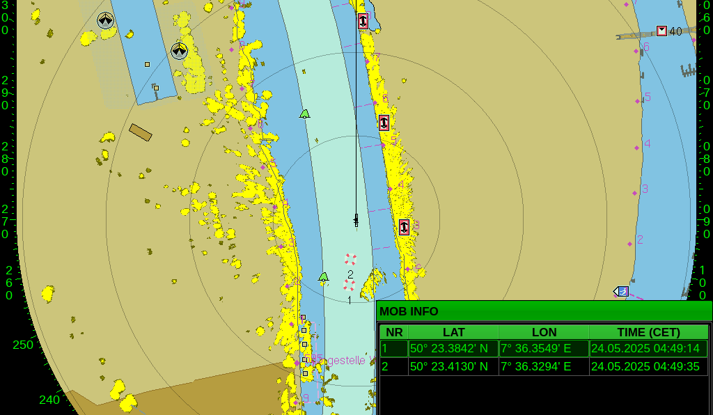
Homme à la mer (MOB)
Réponse instantanée en cas d'urgence
En cas d'homme à la mer, la fonction MOB marque immédiatement l'emplacement exact, aidant l'équipage à revenir rapidement à l'endroit. Cette fonction cruciale augmente considérablement les chances d'un sauvetage réussi.
- Activation d'urgence à un bouton.
- Marquage instantané de la position MOB.
- Retour guidé à l'emplacement exact pour maximiser le succès du sauvetage.
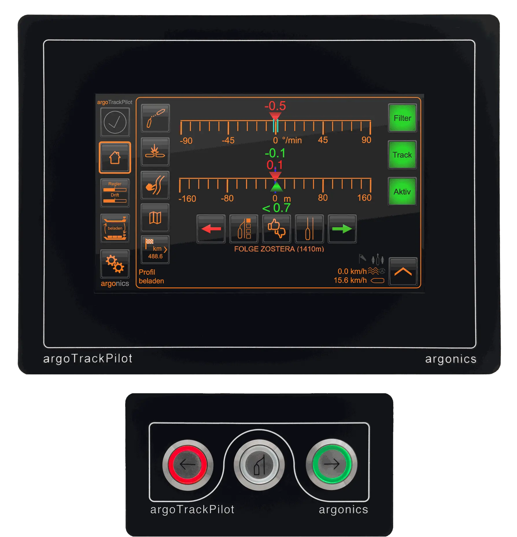
Intégration argoTrackPilot
Navigation automatisée et sans les mains
L'intégration de l'Argo Trackpilot avec le Precision Navigator II permet un contrôle de parcours entièrement automatisé. Cette fonctionnalité rend la navigation sans les mains, permettant aux équipes de se concentrer sur d'autres tâches opérationnelles tout en garantissant un routage précis et efficace.
- Compatibilité parfaite entre le Precision Navigator II et l’argoTrackPilot
- Planifiez et envoyez des itinéraires directement au Trackpilot.
- Le contrôle automatisé des parcours réduit la charge de travail et économise du carburant.
- Navigation optimisée et mains libres avec synchronisation des données en temps réel.
Recherchez-vous les systèmes de navigation les plus avancés et innovants pour votre navire ?
Contactez-nous et découvrez l'ultime en matière de fiabilité, de durabilité et de précision.